Product Description
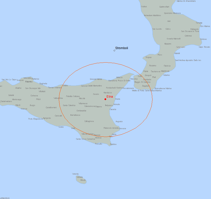
Abstract: This polygon shapefile represents potential area of ash generated by active volcanoes around the world. It is produced by DTN meteorologists and updated once a day.
Purpose: This shapefile can be used to plan flight routes and manage aircraft around volcano threats.
Description: This polygon shapefile represents potential area of ash generated by active volcanoes around the world. It is produced by DTN meteorologists and updated once a day. This shapefile can be used to plan flight routes and manage aircraft around volcano threats.
Product Specification
Shapefile Name: VASHyymmddhh
Fields. Features in this product have the following attributes:
| Name | Type | Format | Description |
|---|---|---|---|
|
PolygonNum |
Number (10) |
n/a |
Polygon identifier |
|
PointNum |
Number (10) |
n/a |
Number of vertices in polygon |
|
Latitude |
Number (18) |
decimal degrees |
Latitude of first vertex |
|
Longitude |
Number (18) |
decimal degrees |
Longitude of first vertex |
|
Name |
String (40) |
n/a |
Volcano name |
|
ValidTime |
String (20) |
mm/dd/yyyy hh:mm:ss |
Valid date and time of volcanic ash area |
|
TotalPts |
Number (10) |
n/a |
Number of vertices in polygon |
|
Location |
String (60) |
n/a |
Descriptive location of volcano |
|
VolcanoLat |
Number (18) |
decimal degrees |
Latitude of volcano |
|
VolcanoLon |
Number (18) |
decimal degrees |
Longitude of volcano |
|
StatusCode |
Number (3) |
n/a |
Coded volcano activity status: 0 = INACTIVE, 1 = ACTIVE |
|
Status |
String (8) |
n/a |
Descriptive volcano activity status: INACTIVE or ACTIVE. |
|
RawTxt1 |
String (220) |
n/a |
Text of volcano advisory |
|
RawTxt2 |
String (220) |
n/a |
Text of volcano advisory |
|
RawTxt3 |
String (220) |
n/a |
Text of volcano advisory |
|
RawTxt4 |
String (220) |
n/a |
Text of volcano advisory |
|
RawTxt5 |
String (220) |
n/a |
Text of volcano advisory |
|
RawTxt6 |
String (220) |
n/a |
Text of volcano advisory |
|
RawTxt7 |
String (220) |
n/a |
Text of volcano advisory |
|
RawTxt8 |
String (220) |
n/a |
Text of volcano advisory |
|
RawTxt9 |
String (220) |
n/a |
Text of volcano advisory |
|
RawTxt10 |
String (220) |
n/a |
Text of volcano advisory |
|
RawTxt11 |
String (220) |
n/a |
Text of volcano advisory |
|
RawTxt12 |
String (220) |
n/a |
Text of volcano advisory |
|
RawTxt13 |
String (220) |
n/a |
Text of volcano advisory |
|
RawTxt14 |
String (220) |
n/a |
Text of volcano advisory |
|
RawTxt15 |
String (220) |
n/a |
Text of volcano advisory |
|
RawTxt16 |
String (220) |
n/a |
Text of volcano advisory |
|
RawTxt17 |
String (220) |
n/a |
Text of volcano advisory |
|
RawTxt18 |
String (220) |
n/a |
Text of volcano advisory |
|
RawTxt19 |
String (220) |
n/a |
Text of volcano advisory |
|
RawTxt20 |
String (220) |
n/a |
Text of volcano advisory |
GeoDatabase Specification
Spatial Table Name: VASH
Views. The following spatial views are available on this spatial table:
| Microsoft SQL Server | Oracle |
|---|---|
|
VASH_View CrntVASH_View |
VASH_View CrntVASH_View |
Columns. Features in this spatial table have the following attributes:
| Name | ArcSDE Data Type |
|---|---|
|
PolygonNum |
Integer |
|
PointNum |
Integer |
|
Latitude |
Double |
|
Longitude |
Double |
|
Name |
String(40) |
|
ValidTime |
String(20) |
|
TotalPts |
Integer |
|
Location |
String(60) |
|
VolcanoLat |
Double |
|
VolcanoLon |
Double |
|
StatusCode |
SmallInt(4) |
|
Status |
String(8) |
|
RawTxt1 |
String(220) |
|
RawTxt2 |
String(220) |
|
RawTxt3 |
String(220) |
|
RawTxt4 |
String(220) |
|
RawTxt5 |
String(220) |
|
RawTxt6 |
String(220) |
|
RawTxt7 |
String(220) |
|
RawTxt8 |
String(220) |
|
RawTxt9 |
String(220) |
|
RawTxt10 |
String(220) |
|
RawTxt11 |
String(220) |
|
RawTxt12 |
String(220) |
|
RawTxt13 |
String(220) |
|
RawTxt14 |
String(220) |
|
RawTxt15 |
String(220) |
|
RawTxt16 |
String(220) |
|
RawTxt17 |
String(220) |
|
RawTxt18 |
String(220) |
|
RawTxt19 |
String(220) |
|
RawTxt20 |
String(220) |