Product Description
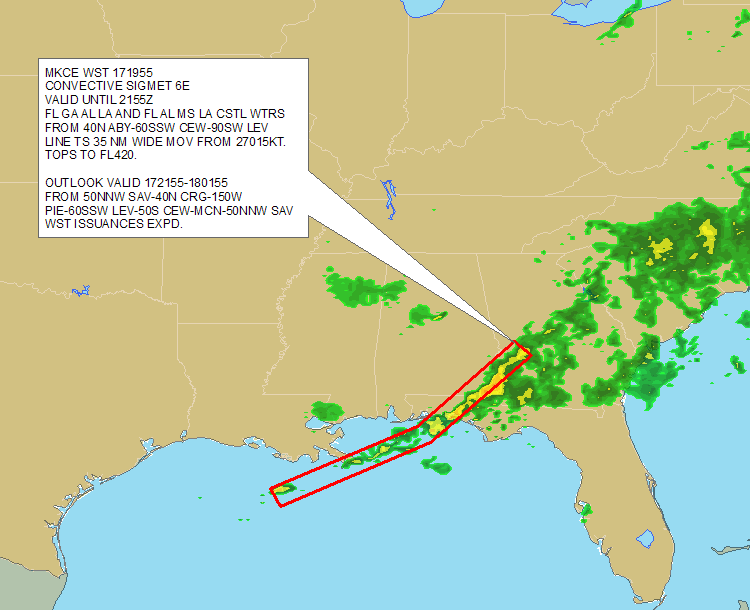
Abstract: This polygon shapefile, which covers the contiguous United States and surrounding waters, identifies areas of potential thunderstorm activity based on advisories from the National Weather Service Aviation Weather Center. Convective SIGMET shapefiles are updated hourly.
Purpose: This shapefile can be used to plan flight routes and manage aircraft around thunderstorm threats.
Description: DTN decodes and geo-references each Convective SIGMET bulletin from the National Weather Service Aviation Weather Center for use in your GIS. Decoded convective information includes type, height (top), movement, extent and valid times. Coverage includes the lower 48 United States and adjacent coastal waters. Use this information to alert flight planners, pilots and operators of all aircraft of areas with active convective weather. Convective SIGMETs identify areas of severe convective weather, including: Surface Severe Weather; Surface winds greater than or equal to 50 knots; Hail at the surface greater than or equal to 3/4 inches in diameter; Tornadoes; Embedded thunderstorms; Lines of thunderstorms; Thunderstorms of moderate or greater intensity affecting 40% or more of an area of at least 3,000 square miles. A convective SIGMET implies severe or greater turbulence, severe icing, and low level wind shear.
Product Specification
Shapefile Name: WPCSyymmddhh
Fields. Features in this product have the following attributes:
| Name | Type | Format | Description |
|---|---|---|---|
|
WSTID |
Number (10) |
n/a |
Convective SIGMET bulletin identification number |
|
PolygonNum |
Number (10) |
n/a |
Polygon identification number |
|
ValidTime |
String (20) |
mm/dd/yyyy hh:mm:ss |
Start or update time of advisory |
|
ExpireTime |
String (20) |
mm/dd/yyyy hh:mm:ss |
End time of advisory |
|
RegionNum |
Number (10) |
n/a |
Region number (1 = East, 2 = Central, 3 = West) |
|
PNumber |
Number (10) |
n/a |
|
|
PointNum |
Number (10) |
n/a |
|
|
TotalPts |
Number (10) |
n/a |
Total number of polygon vertices |
|
Type |
Number (10) |
n/a |
UNKNOWN = 0; |
|
Width |
Number (10) |
nautical miles |
Width of area in miles |
|
Speed |
Number (10) |
knots |
Speed of movement |
|
Direction |
Number (10) |
degrees |
Direction of movement |
|
MaxTops |
Number (10) |
ft/100 |
Maximum height of thunderstorms (above ground level) |
|
ConSigNum |
Number (10) |
n/a |
Convective SIGMET identification number |
|
Latitude |
Number (18) |
decimal degrees |
Recommended location of contour label |
|
Longitude |
Number (18) |
decimal degrees |
Recommended location of contour label |
|
ObjectTxt1 |
String (220) |
n/a |
Convective SIGMET advisory (does not include outlook) text |
|
ObjectTxt2 |
String (220) |
n/a |
Convective SIGMET advisory (does not include outlook) text |
|
RawTxt1 |
String (220) |
n/a |
Convective SIGMET bulletin text including 2-6 hour outlook |
|
RawTxt2 |
String (220) |
n/a |
Convective SIGMET bulletin text including 2-6 hour outlook |
|
RawTxt3 |
String (220) |
n/a |
Convective SIGMET bulletin text including 2-6 hour outlook |
|
RawTxt4 |
String (220) |
n/a |
Convective SIGMET bulletin text including 2-6 hour outlook |
|
RawTxt5 |
String (220) |
n/a |
Convective SIGMET bulletin text including 2-6 hour outlook |
|
RawTxt6 |
String (220) |
n/a |
Convective SIGMET bulletin text including 2-6 hour outlook |
|
RawTxt7 |
String (220) |
n/a |
Convective SIGMET bulletin text including 2-6 hour outlook |
|
RawTxt8 |
String (220) |
n/a |
Convective SIGMET bulletin text including 2-6 hour outlook |
GeoDatabase Specification
Spatial Table Name: WPCS
Views. The following spatial views are available on this spatial table:
| Microsoft SQL Server | Oracle |
|---|---|
|
WPCS_View FcstConvSIGMETS_View |
WPCS_View FcstConvSIGMETS_View |
Columns. Features in this spatial table have the following attributes:
| Name | ArcSDE Data Type |
|---|---|
|
ValidTime |
String(20) |
|
ExpireTime |
String(20) |
|
WSTID |
Double |
|
PolygonNum |
Double |
|
RegionNum |
Double |
|
PNumber |
Double |
|
PointNum |
Double |
|
TotalPts |
Double |
|
Type |
Double |
|
Width |
Double |
|
Speed |
Double |
|
Direction |
Double |
|
MaxTops |
Double |
|
ConSigNum |
Double |
|
Latitude |
Double |
|
Longitude |
Double |
|
ObjectTxt1 |
String(220) |
|
ObjectTxt2 |
String(220) |
|
RawTxt1 |
String(220) |
|
RawTxt2 |
String(220) |
|
RawTxt3 |
String(220) |
|
RawTxt4 |
String(220) |
|
RawTxt5 |
String(220) |
|
RawTxt6 |
String(220) |
|
RawTxt7 |
String(220) |
|
RawTxt8 |
String(220) |