Product Description
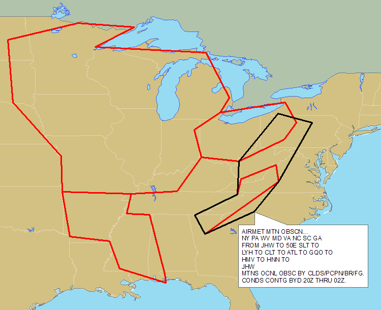
Abstract: This polygon shapefile, which covers the contiguous United States and surrounding waters, identifies areas of low cloud ceilings, low surface visibilities or mountain tops obscured by clouds based on advisories from the National Weather Service Aviation Weather Center. AIRMET IFR/Mountain Obscuration shapefiles are updated hourly.
Purpose: This shapefile can be used to plan flight routes and manage aircraft around visibility threats.
Description: Ceiling AIRMETs identify widespread regions with Instrument Flight Rules (IFR) conditions with cloud ceilings less than 1,000 feet and/or surface visibility less than three miles, or extensive mountain obscuration. DTN decodes and geo-references each AIRMET bulletin from the National Weather Service Aviation Weather Center for use in your GIS. Decoded ceiling information includes type, extent and valid times. Coverage includes the lower 48 United States and surrounding coastal waters. Use this information to alert flight planners, pilots and operators of all aircraft of regions with low clouds, poor visibilities, and obscured mountain tops.
Product Specification
Shapefile Name: WPXSyymmddhh
Fields. Features in this product have the following attributes:
| Name | Type | Format | Description |
|---|---|---|---|
|
PolygonNum |
Number (10) |
n/a |
Polygon identification number |
|
Latitude |
Number (18) |
decimal degrees |
Recommended location of contour label |
|
Longitude |
Number (18) |
decimal degrees |
Recommended location of contour label |
|
PointNum |
Number (10) |
n/a |
|
|
SevCat |
Number (10) |
n/a |
Not used (always 1) |
|
StationID |
String (10) |
n/a |
Issuing aviation weather center service unit |
|
AirmetType |
String (10) |
n/a |
AIRMET type (SIERRA) |
|
ValidTime |
String (20) |
mm/dd/yyyy hh:mm:ss |
Start or update time of advisory |
|
ExpireTime |
String (20) |
mm/dd/yyyy hh:mm:ss |
End time of advisory |
|
UpdateNum |
Number (3) |
n/a |
Current update number (number of times bulletin has been updated) |
|
MessageID |
Number (3) |
n/a |
Sequential weather center message identifier |
|
TotalPts |
Number (10) |
n/a |
Total number of polygon vertices |
|
MessageTyp |
String (20) |
n/a |
AIRMET type description (IFR, MTN OBSC) |
|
Severity |
String (20) |
n/a |
Not used |
|
IceType |
String (10) |
n/a |
Not used |
|
MsgTxt1 |
String (220) |
n/a |
Message body text |
|
MsgTxt2 |
String (220) |
n/a |
Message body text |
|
MsgTxt3 |
String (220) |
n/a |
Message body text |
|
MsgTxt4 |
String (220) |
n/a |
Message body text |
|
MsgTxt5 |
String (220) |
n/a |
Message body text |
|
MsgTxt6 |
String (220) |
n/a |
Message body text |
|
MsgTxt7 |
String (220) |
n/a |
Message body text |
|
MsgTxt8 |
String (220) |
n/a |
Message body text |
|
BulTxt1 |
String (220) |
n/a |
Other bulletin text |
|
BulTxt2 |
String (220) |
n/a |
Other bulletin text |
|
BulTxt3 |
String (220) |
n/a |
Other bulletin text |
|
BulTxt4 |
String (220) |
n/a |
Other bulletin text |
|
BulTxt5 |
String (220) |
n/a |
Other bulletin text |
|
BulTxt6 |
String (220) |
n/a |
Other bulletin text |
|
BulTxt7 |
String (220) |
n/a |
Other bulletin text |
|
BulTxt8 |
String (220) |
n/a |
Other bulletin text |
GeoDatabase Specification
Spatial Table Name: WPXS
Views. The following spatial views are available on this spatial table:
| Microsoft SQL Server | Oracle |
|---|---|
|
WPXS_View FcstAirmetIFR_View |
WPXS_View FcstAirmetIFR_View |
Columns. Features in this spatial table have the following attributes:
| Name | ArcSDE Data Type |
|---|---|
|
ValidTime |
String(20) |
|
ExpireTime |
String(20) |
|
PolygonNum |
Integer |
|
Latitude |
Double |
|
Longitude |
Double |
|
PointNum |
Integer |
|
SevCat |
Integer |
|
StationID |
String(10) |
|
AirmetType |
String(10) |
|
UpdateNum |
Integer |
|
MessageID |
Integer |
|
TotalPts |
Integer |
|
MessageTyp |
String(20) |
|
Severity |
String(20) |
|
IceType |
String(10) |
|
MsgTxt1 |
String(220) |
|
MsgTxt2 |
String(220) |
|
MsgTxt3 |
String(220) |
|
MsgTxt4 |
String(220) |
|
MsgTxt5 |
String(220) |
|
MsgTxt6 |
String(220) |
|
MsgTxt7 |
String(220) |
|
MsgTxt8 |
String(220) |
|
BulTxt1 |
String(220) |
|
BulTxt2 |
String(220) |
|
BulTxt3 |
String(220) |
|
BulTxt4 |
String(220) |
|
BulTxt5 |
String(220) |
|
BulTxt6 |
String(220) |
|
BulTxt7 |
String(220) |
|
BulTxt8 |
String(220) |