Product Description
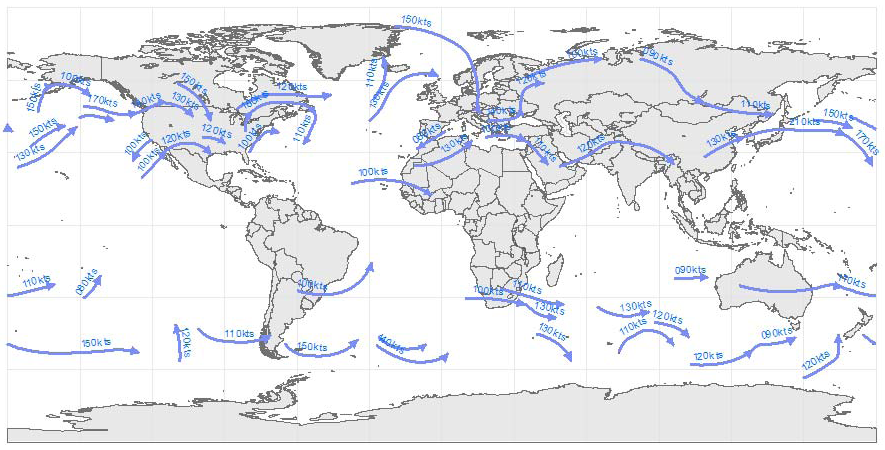
Abstract: These polyline shapefiles identify worldwide forecasts of jet steam axis locations at 6, 12, 18 and 24 hours into the future based on analyses of upper level wind products by DTN meteorologists. Jet stream forecast shapefiles are updated every 6 hours.
Purpose: These shapefiles can be used to plan flight routes and manage aircraft around headwind threats and to optimize aircraft fuel usage.
Description: These worldwide polyline shapefiles identify forecast location and maximum speed of jet steam axis at 6, 12, 18 and 24 hours into the future based on analyses of upper level wind products produced by DTN meteorologists. This layer is typically used to build a high level significant aviation weather forecast product. Jet stream forecasts are updated four times a day.
Product Specification
Shapefile Name: JETS???yymmddhh
Fields. Features in this product have the following attributes:
| Name | Type | Format | Description |
|---|---|---|---|
|
HiLvlJet_T |
String (10) |
knots |
Maximum jet stream wind speed |
|
HiLvlJet_L |
String (6) |
ft/100 |
Flight level of maximum wind speed |
|
Valid_Date |
Date (8) |
mm/dd/yyyy |
Valid date of jet stream forecast |
|
Valid_Time |
String (5) |
hour |
Valid time (GMT) of jet stream forecast |
|
ValidDateT |
Date (8) |
mm/dd/yyyy hh:mm:ss |
Valid date and time of jet stream forecast |
|
Most_Recen |
Number (5) |
n/a |
Processing flag |
GeoDatabase Specification
Spatial Table Name: JETS
Views. The following spatial views are available on this spatial table:
| Microsoft SQL Server | Oracle |
|---|---|
|
JETS_View |
JETS_View |
Columns. Features in this spatial table have the following attributes:
| Name | ArcSDE Data Type |
|---|---|
|
HiLvlJet_T |
String(4) |
|
HiLvlJet_L |
String(4) |
|
Valid_Date |
Date |
|
Valid_Time |
String(5) |
|
ValidDateT |
Date |
|
Most_Recen |
SmallInt(4) |