Product Description
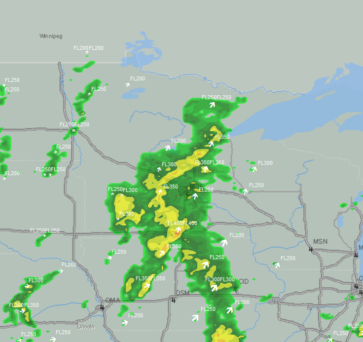
Abstract: This point shapefile, which covers the contiguous United States and surrounding waters, identifies the highest elevation at which precipitation is detected by weather radar in an area of precipitation. It is produced from NEXRAD Decoded Attribute Table information, and is nominally updated every five minutes.
Purpose: This shapefile can be used to plan flight routes and manage aircraft around thunderstorm threats, but can also be used to determine storm intensity.
Description: This point shapefile, which covers the contiguous United States and surrounding waters, identifies the highest elevation at which precipitation is detected by weather radar in an area of precipitation. It is produced from NEXRAD Decoded Attribute Table information, and is nominally updated every five minutes. This shapefile can be used to plan flight routes and manage aircraft around thunderstorm threats, but can also be used to determine storm intensity.
Product Specification
Shapefile Name: USEThhmm
Fields. Features in this product have the following attributes:
| Name | Type | Format | Description |
|---|---|---|---|
|
Rank |
Number (10) |
n/a |
Priority, used to increase/decrease number of points displayed at different map scales: 1 = highest priority, …, 4 = lowest priority |
|
Latitude |
Number (18) |
decimal degrees |
Latitude of echo top |
|
Longitude |
Number (18) |
decimal degrees |
Longitude of echo top |
|
Height |
Number (10) |
ft |
Elevation of echo top |
|
IsDup |
Boolean (1) |
n/a |
Same point exists in shapefile with different rank |
|
MovDir |
Number (10) |
degrees |
Direction of movement |
|
MovSpeed |
Number (10) |
knots |
Speed of movement |
|
StormLat |
Number (18) |
decimal degrees |
Not used |
|
StormLon |
Number (18) |
decimal degrees |
Not used |
|
TVSCode |
Number (10) |
n/a |
Tornadic Vortex Signature with three possible states: 0 = NONE, 1 = ETVS, 2 = TVS |
|
MesoCode |
Number (10) |
n/a |
Mesocyclone with four possible states: 0 = NONE, 1 = UNCO, 2 = 3D, 3 = MESO |
|
SvrHailPrb |
Number (10) |
percent |
Probability of hail ¾-inch in diameter or greater |
|
HailSzMod |
String (1) |
n/a |
MaxHailSize modifier (e.g. greater than, less than) |
|
MaxHailSz |
Number (18) |
inches |
Maximum size of hail. A -1000 value indicates a storm cell was detected, but hail size cannot be determined. |
GeoDatabase Specification
Spatial Table Name: USET
Views. The following spatial views are available on this spatial table:
| Microsoft SQL Server | Oracle |
|---|---|
|
USET_View CrntEchoTops_view |
USET_View CrntEchoTops_View |
Columns. Features in this spatial table have the following attributes:
| Name | ArcSDE Data Type |
|---|---|
|
Rank |
Integer |
|
Height |
Integer |
|
MovDir |
Integer |
|
MovSpeed |
Integer |
|
TVSCode |
Integer |
|
MesoCode |
Integer |
|
SvrHailPrb |
Integer |
|
HailSzMod |
String(4) |
|
MaxHailSz |
Float |
|
IsDup |
SmallInt(1) |
|
Latitude |
Double |
|
Longitude |
Double |